


.")
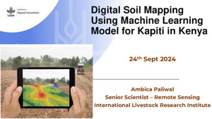
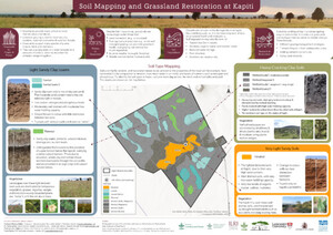
Mapping Kapiti’s soils: A foundation for rangeland restoration
How do you investigate the makeup of soil which is millions of years old?
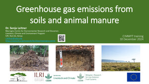
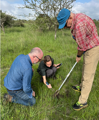
Dig a pit. At Kapiti Research Station and Wildlife Conservancy, in the semi-arid southern rangelands of Kenya, this means a deep soil pit of 2 x 2 x 1.5 m.
Researchers here are studying soils to answer vital questions. How are grasslands affected by livestock and wildlife grazing? Which role does manure deposition play for microbial soil processes? What marks degraded grassland soils, and how do we restore them? And the first step is to know what type of soils are lying below the grasslands.

Soils are the foundation of terrestrial ecosystems, holding essential water, nutrients and minerals for many critical species on the planet from plants to bacteria to fungi.
"Creating a baseline of knowledge for the type of soils at Kapiti will help us test different hypotheses and tell us which factors are important for successful restoration of degraded soils," said Mariana Rufino, professor of livestock systems at the Technical University of Munich.
Rufino is a visiting scientist at ILRI, partnering with the team of ILRI’s Mazingira Centre to conduct research. She is mapping the soils of Kapiti in partnership with Charles Gachene, professor of soil science at the University of Nairobi. They used a two-pronged approach. First, using satellite images to understand the landscape and landforms, and second, sampling relevant units to represent main soil types. Finally the information was aggregated using geographic information system (GIS) layers to construct the overall map of the ranch.
With the help of a team from Kapiti, they dug 14 pits to look at the soil profiles and see how the soil changes with depth. They also analysed soil samples for clay and sand content, nutrients and carbon levels, and other properties in the laboratory.
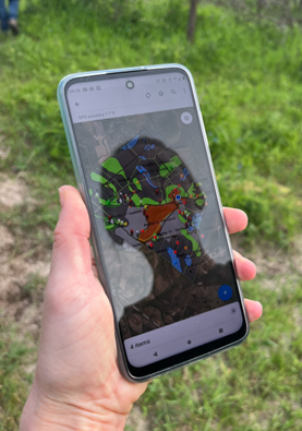
What existed before the team came in was a broad exploratory soil map of Kenya that categorized Kapiti as one soil mapping unit. However, the team's data collected show that there is more than one type of soil present at Kapiti. The team then used the data to create an open-access soil map to showcase what types of soils are present at Kapiti.
The map will aid future research in Kapiti and the broader area by helping researchers to identify site-level differences in soil types. The map will help design better and wide-ranging research, from restoration of degraded rangelands, the role of manure for nutrient circularity, soil carbon sequestration, and sustainable dryland food production. All of these topics are influenced by the type and health of soils.
‘For our soil map, we have identified 10 different soil mapping units that are influenced by the geology and topography of the area and are separated by their physical and chemical properties. With this baseline data, we can monitor changes in soil properties over a given period of time based on different soil management practices,’ said Gachene.
The map shows the boundaries of each soil type across the conservancy, so when researchers want to test interventions on a specific type of soil, they will know where to go. It will also help scientists like Fiona Pearce, a PhD student with Lancaster University, Technical University of Munich and Mazingira to better understand the relationship between grazing management, soil type, plant communities, and grassland productivity. This will enable her to create context-specific recommendations for rangeland restoration that consider the soils, which increases the likelihood of restoration success.
Read the latest blogs from Mazingira Centre here


")

")
")